
Revolutionizing Utilities Management with Aerial Mapping Technologies
In today’s rapidly evolving landscape of utilities management, the integration of technology has become instrumental in enhancing operational efficiency and decision-making processes. Aerial mapping technologies have emerged as a game-changer in the utilities sector, offering innovative solutions to complex challenges faced by utility companies. This article delves into the transformative impact of aerial mapping technologies on utilities management and explores the opportunities and challenges associated with their implementation.
How Aerial Mapping Technologies are Transforming Utilities Management
One of the key advantages of aerial mapping technologies in utilities management is the significant enhancement in operational efficiency that they provide. By utilizing drones and advanced mapping software, utility companies can swiftly and accurately survey vast areas of infrastructure, allowing for timely detection of anomalies or issues that require attention.
Enhancing Efficiency through Aerial Mapping
Aerial mapping streamlines the inspection and maintenance processes of utilities infrastructure, reducing the time and resources required for manual surveys. This efficiency boost enables utilities companies to proactively address potential problems before they escalate, thereby enhancing overall system reliability.
Cost-Benefit Analysis of Aerial Mapping in Utilities Sector
While the initial investment in aerial mapping technologies may seem substantial, the long-term cost savings they offer outweigh the upfront expenses. The ability to detect issues early, optimize maintenance schedules, and minimize downtime results in significant financial benefits for utilities companies over time.
Improving Decision-Making with Aerial Mapping Data
The data collected through aerial mapping provides utilities managers with valuable insights into their infrastructure, enabling data-driven decision-making. By leveraging accurate and up-to-date information, decision-makers can prioritize maintenance activities, allocate resources efficiently, and ensure the optimal performance of utility systems.
Challenges and Solutions in Implementing Aerial Mapping for Utilities
Despite the numerous benefits of aerial mapping technologies, their implementation in the utilities sector comes with challenges that need to be addressed effectively. From privacy concerns to technical integration issues, utilities companies must navigate various hurdles to maximize the potential of aerial mapping.
Addressing Privacy Concerns with Aerial Mapping
Privacy regulations and public perception of aerial surveillance pose challenges for utilities companies utilizing aerial mapping technologies. It is crucial for companies to adhere to strict privacy standards, communicate transparently with stakeholders, and ensure that data collected through aerial mapping is used responsibly and ethically.
Integrating Aerial Mapping with Existing Utilities Infrastructure
Integrating aerial mapping systems with existing utilities infrastructure can be a complex process that requires careful planning and coordination. Utilities companies need to ensure seamless integration of aerial mapping data with their current management systems to maximize operational efficiency and data utility.
Training Requirements for Personnel to Operate Aerial Mapping Systems
Effective utilization of aerial mapping technologies necessitates adequately trained personnel who can operate drones, analyze mapping data, and interpret results accurately. Providing comprehensive training programs for employees is essential to ensure the successful implementation and utilization of aerial mapping systems within utilities companies.
Regulatory Framework for Aerial Mapping in Utilities Sector
As the adoption of aerial mapping technologies in the utilities sector increases, regulatory frameworks play a crucial role in ensuring compliance, data security, and privacy protection. Utilities companies must adhere to industry standards and regulations to mitigate risks associated with aerial mapping.
Compliance Standards for Aerial Mapping Data Usage
Regulatory bodies set compliance standards for the collection, storage, and usage of aerial mapping data to safeguard sensitive information and prevent misuse. Utilities companies must comply with these standards to maintain trust with customers and stakeholders and avoid legal implications.
Privacy Regulations and Aerial Mapping
Privacy regulations specific to aerial mapping technologies are put in place to protect individuals’ privacy rights and ensure responsible data handling practices. Utilities companies must stay abreast of relevant privacy laws and regulations to safeguard the privacy of individuals and maintain compliance with legal requirements.
Future Trends in Aerial Mapping Technologies for Utilities
The future of aerial mapping technologies in the utilities sector holds promising advancements that will further revolutionize utilities management practices. From the integration of artificial intelligence to the evolution of drone technology, utilities companies can expect continued innovation in the way aerial mapping is utilized.
Role of Artificial Intelligence in Enhancing Aerial Mapping Efficiency
Artificial intelligence (AI) holds immense potential in optimizing aerial mapping processes by automating data analysis, identifying patterns, and predicting maintenance needs. AI-powered solutions can enhance the accuracy and speed of mapping activities, enabling utilities companies to make informed decisions more efficiently.
Advancements in Drone Technology for Aerial Mapping
Ongoing advancements in drone technology are making aerial mapping more accessible, cost-effective, and reliable for utilities companies. With improved flight capabilities and enhanced sensor technology, drones equipped with GNSS technology and connected to an RTK receiver are becoming increasingly sophisticated. This allows utilities managers to gather high-quality data with greater precision and detail, ensuring that aerial mapping can be conducted with centimeter-level accuracy. This level of precision provides utilities companies with the detailed insights needed for efficient management and planning.
Integration of Virtual Reality in Utilities Management through Aerial Mapping
The integration of virtual reality (VR) technologies with aerial mapping data offers utilities companies new ways to visualize and interact with their infrastructure. VR simulations can provide immersive insights into complex utility systems, enabling better planning, training, and decision-making in utilities management.
Case Studies: Successful Implementations of Aerial Mapping in Utilities Sector
Real-world case studies exemplify the tangible benefits of aerial mapping technologies for utilities companies, showcasing successful implementations and outcomes that have transformed utilities management practices.
Case Study 1: Increasing Grid Resilience with Aerial Mapping
By employing aerial mapping technologies to monitor power grid infrastructure, a utility company was able to identify vulnerabilities, proactively address maintenance needs, and enhance the resilience of the grid against outages and disruptions.
Case Study 2: Enhancing Pipeline Monitoring through Aerial Mapping
A utilities provider utilized aerial mapping to inspect and monitor pipeline networks, detecting leaks, corrosion, and other issues that could compromise pipeline integrity. This proactive approach to monitoring enabled timely maintenance and minimized risks of environmental damage.
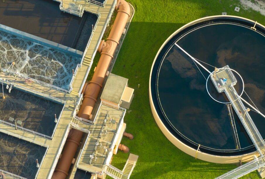
Case Study 3: Optimizing Water Resource Management with Aerial Mapping
Through the adoption of aerial mapping technologies, a water utility optimized its water resource management by identifying areas of water loss, monitoring reservoir levels, and improving infrastructure planning. The insights gained from aerial mapping data enabled more efficient water distribution and conservation practices.